Monday, February 4, 2013

Eat, Hike and Ride at Mt. Balagbag with the USAP Mountaineers, USAP MTB and the USAP 2-Wheels Clubs

Mt. Balagbag
Rodriguez, Rizal

Feb. 3, 2013

Which is much faster, wheels or feet? This past Sunday, the said question was finally answered when our club USAP Mountaineers joined forces with the USAP MTB and the USAP 2-Wheels clubs in a trailblazing affair in Mt. Balagbag.On any given day, the easy bet would be wheels but this was no ordinary day as we were all in a competitive spirit to race on the said mountain.


The whole gang:USAP Mountaineers, USAP MTB and USAP 2-Wheels

As mentioned; there were three clubs involve so went to the jump-off separately. The mountaineers went to Licao-licao through the Tungko route while the MTB club took the Montalban route. There were only two participants from the 2-wheels club and one took the former trail while the other one used the latter route.

On our way to Licao-Licao
Upon our arrival. we saw sir Julius of the 2-wheels club already waiting for us. And so the winner of the first leg goes to their club. In fact, he went with us without his motorcycle and he even lead the way for majority of the trail.

Sir Julius leads the way minus his motorcycle
Half an hour later, the MTB club had arrived and we commenced our journey to the helipad. Probably, we were given a 15 minute head start by the bikers and still they were able to catch up by the time we reached the school in Balagbag.

At the midpoint of the trail, the bikers had caught us
However, we took back the lead when the the trail became a steep and rocky assault. And we held the lead for good by a long margin. Thank you very much steep trail. We appreciate your humble assistance in making their ascent a burden.

See how hard it was
During the ascent, it is notably worth to mention that the sight was breath-taking as one could see the Sierra Madre mountain range as well as Mt. Arayat in Pampanga. The skyline of the buildings in Ortigas can be seen as well. Minutes past nine in the morning, I already reached the gate en route to the Helipad. Right after, a house could be seen and served as the registration site that cost ten pesos.

A week before the year of the snake comes, a dead snake welcomed us just before the registration site
Sir Julius and I were the first one to register and did not wait for the others. One of the locals instructed us to use the shortcut en route to the Helipad and so we used it while the others use the long route. The trail was much more I am accustomed to as it was narrow and steep and full of tall grasses. True enough, in just ten minutes, I was able to reach the highest point of the mountain, i.e. the Helipad. Aside from the privilege of being all alone in a mountain with a gorgeous view of the mountain range of Sierra Madre, I am also proud to brag that the Mountaineers went there first.

Victory for the Mountaineers

Moments later, Julius was able to reached the top. Then the sun made his presence for awhile just before the other mountaineers arrived. Afterwards, the MTB crew one-by-one made it finally to the top and greeted with loser signs.

A proud achievement for the USAP MTB Club
And the winner is....
The Mountaineers had their lunch there and rested in a hut nearby the helipad and joined in by the MTB crew as well. While me, Julius and sir Lemuel stayed behind. I took the opportunity to have a serene and peaceful thought of my lolo who departed five days earlier and was cremated 24 hours earlier. 

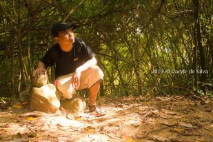
For a brief time, I did not have fun in this hike
Just before noon, we had our photo session. This time the bikers made the most of the time pedaling as it was downhill to the jump-off. I was the only one able to catch them but only momentarily. One side note was a local trying to be funny asked me where was my bike. I took it as a compliment but I accept my fate of not beating them downhill because I had neither front or rear brakes like them. By the time I reached the jump-off point, they were all having their lunch. More than an hour later, the others arrived as they drop by at the falls who had a few water to offer.

All set to leave

Thank you for all those who participated in this unique event of conquering a mountain
Thank you Sir Dada for the photos


P.S.

On a personal note; this is a tribute climb for my lolo Bugs. Surely, I will miss him very much dearly.

Engr. Orestes "Bugs" M. Delos Reyes
Jan. 12, 1932 - Jan. 29, 2013
The engineer and the future mountaineer


Monday, January 28, 2013

Mt.Pico de Loro: A Mudless Fun Climb

January 27, 2012

Pico de Loro
Ternate, Cavite


When I went to Pico de Loro recently; I had three certainties.

1. I'll have trouble making to the monolith without a rope.
2. I'll end up with another traumatic experience there like the first three times.
3. There are no water source at the campsite or summit.

When I return from Pico de Loro; I have one certainty:

1. Climbing Pico de Loro is fun without the mud.

Yes, just like you, I was confused. My fourth climb in Pico de Loro was a very confusing hiking experience.

I think I had much fun this time!


I have been to this mountain every year since I started this endeavor in 2010. So I had my annual tradition this year on a forecasted cloudy Sunday weather.


Before the climb

It was indeed cloudy at the start of the day. We begin our trek few minutes after seven in the morning. Unlike the first three times; the trail had no sign of any mud as it was dry and solid to step on. Another thing relatively new to me was the yellow marks painted on the trees along the trail.

It's like going to Oz with out the brick road but the yellow mark trees


It took us only half an hour when reached the base camp. We registered again. I went near the house to get water when I was surprised that the water source has a faucet already and there's also a shower room established.

Look we were having fun


After taking some photos, we resume our trek. As far I recall, there at least four river crossing but there were none on that day. The stream was dry and no trace of water can be seen.

It used to have water there


Another thirty minutes have gone when we reached the fork trail to the mountain and the falls. We rested there for a bit before resuming our journey.

Follow the Light

From the Alibangbang station up to the campsite; we have came across with mountaineers on their way descend to the jump-off. They were so many that I lost my count. So to speak, I mentioned a lot of good morning sir and ingat a countless times during our ascend. During that span there were even old hikers that a little bit tipsy or had hangover still.

When we reached the campsite, I was surprised to what I discover there. A store in resemblance to the 7-11 store in Maculot was set-up there to sell refreshments to fellow hikers. I might say the price is reasonable there as a bottle of mountain dew cost thirty pesos while a Red Horse Grande bottle cost a hundred pesos each.

Bili na kayo!
Then we were of to the summit. As expected a steep assault was waiting for us. However, I did not have any trouble on my ascend perhaps due to my previous three stints there or my improved endurance brought my consistent climbing. When I reached the summit, I was so happy to enjoy the glorious view it bestow.

This is how you descend from the summit
It does not end there as another obstacle to pursue; the monolith. I have been there once and it almost cost my life but being a "buhis-buhay" adventurer I have to do it again. I was certain that there were no rope to use there as told by the hikers I asked while I was on the trail. However, there was a rope tied there to be use by one who dare to climb the monolith.

Super Mountaineer!
While the others were still up to the summit; I went there first. As a result, I was there by my lonesome. Alone but happy. Just me and Mother Nature. Away from the problems in civilization. No glimpse of frustrations. I forgot for awhile the fate of my friends who were retrenched from our company. It was ironic that during that moment; I had  clear mind even if there was an unclear future waiting for me upon my return to reality. Perhaps this is the reason I enjoy climbing mountains; it clears my mind even for just momentarily.

All Alone

Then two mountaineers came and ruin my emo moment. Afterwards, the rest of my group arrived there. We had a blast there as we made crazy stunts for a ridiculous photo session at the top of the mountain.

Hurray!!!
We were there for a long time. As a result, we had our lunch at 2 in the afternoon. Hungry and tired, still it was all worth it especially after seeing all the photos. By three in the afternoon, we made our descend. In less than two hours, we made it back in the DENR station.

On our way home


Meet the Survivor Six

Dennis

Kiko
Tootz
Gem
Dada

Phil (the Author)

Acknowledgment

Thank you to Dada for the photos as well for organizing the climb
Thank you to sir Kicks, Kuya Tootz, Ma'am Gem and Dennis for accompanying me in this hike

See you next time Pico de Loro!

Driving my invisible car

Friday, January 25, 2013

Flirting with Mt. Makiling


January 20, 2013

Los BaƱos, Laguna

Since I became a mountaineer, I always made UPLB synanimous to Mt. Makiling because that was the place where the said mountain can be located. In my three years of mountaineering, I never trek Mt. Makiling. I had a lot of invites but I turned down all of them due to my fear of limatiks (blood leeches). Now, that I conquered what I am afraid of, I am fully ready to do a Makiling Traverse or MakTrav as popularly known. However due to a fateful tragedy wherein two had died and discovered their bodies lying there, beforet the end of the year, the mountain was temporarily closed.

And so when I went to UPLB on a very fine Sunday morning to attend a christening, I was somehow frustrated of not trekking the mountain since I was already there. I just gazed upon her and thought that someday I'll have my chance to conquer her.

Eventhough I did not climb that day, it was fine with me because I had a wonderful time seeing the mountains around the area. Some were already been conquered and it was nice to see them in another perspective (of course all of this while I was having a delightful lunch).

After a while we decided to leave the reception and went back home. As told by my uncle to buy pasalubong in The Original Buko Pie, which according to him was famous due to its delicious and crusty pies. True enough, the line was long andI bought two boxes of buko pie in  store worth 150.00 each.

Monday, January 21, 2013

A Foggy Tarak Ridge Dayhike


Tarak Ridge Dayhike

January 13, 2013
Mt. Tarak Ridge
Mariveles, Bataan

Participants 

Only Ben and I were able to make it. Due to the unfriendly weather, my friend Dennis had to back out. I couldn't blame him because almost all week long, the weather in the metro was rainy. But the weather there was fine contrary to our expectations.

Meetup Point

I arrived few minutes after one in the morning. Yes, it's no typo, the meetup time was 1 AM. Ten minutes or so later, Ben arrived at Genesis terminal in Cubao.

Minutes later, we boarded a Mariveles bound bus enroute to Brgy. Alas-Asin, which is the starting point of our trek.

The ride was more than a couple of hours so we able to have a nap.

Half past four in the morning, we arrived in the jump-off point. It was still dark but we decided to move forward until we reached Nanay Cording's place. It took us almost an hour to get there due to darkness. (We only used the flashlight from my tiny cellphone).

Waiting Game

Dogs started to bark and it was a good sign because we already reached Nanay's place. She was already awake and made us sign in her logbook. We rested there until the sun made its prescence felt.

While waiting for the sun to come up, Ben was playing with Nanay's pet cat. Meanwhile, Still longing for sleep, I was resting in a hammock.

Then as greek mythology claims, the god Apollo while riding a chariot starts to raise the sun up to the sky. And it was the sign that we should now commence our journey.

It's been six months since I have been there and so I was having a hard time to remember the trail but fortunately the mountain was not hard to navigate.

The first part was a gradual trail ascent to the grasslands. Then the uphill-downhill trek towards the river. One interesting note was the rope we used the first time was missing. But even ropeless, it was not difficult to go down the cliff.

An hour and a half later, we rested and ate our breakfast in the Papaya River. There, we met fellow hikers who spent the night there.

False Alarm

Then the hard part begins. From the river up to the ridge, steep ascends are waiting. Luckily for us, we have no heavy pack so we able to do it without exerting too much physical strains to our bodies. While going up, being the pacer, I saw a body lying to the ground. At first glance, I thought it was an emergency but luckily he was just sleeping. It turned out that he was so wasted the night before that he could not able to make it to the top.

When we were about to reach the ridge, we have crossed with mountaineers who pitched camp there and o nthe way down to the river.

Foggy

Alas, we made it up to the ridge where the sun was waiting for us. However, it was only a minute as mist was already covering the whole place. Damn, Tarak still owe me a clearing. (Like the first time, I only had a glimpse of the view that the mountain gloriously boast). Due to the great fog, most of us who were there did not push through in conquering the summit. One of my favorite dialogue is Zero visibility only brings danger which means I want to get tired of pursuing a lose effort.

We stayed there until 10 am, and we made it back to the river in an hour. We did not take much time there and move forward again. When we reached the grasslands it was almost noon already. Then the mistake I always remember when we took a different turn and ended in another trail. But unlike the first time when we got lost, this time we somehow made a traverse as we ended a hundred meters away from Nanay's place. So we turned back to refresh ourselves there. At around 2 in the afternoon, we had our lunch at the national highway. Then we boarded a Pasay bound bus.

And so at the end of the day even I was able to trek it 6 hours back and forth, the mountain named Tarak still owe me a panoramic view of Corregidor and Manila Bay alongside of other coastal views that can be seen at the top. I vow to return sooner rather than later.

Tuesday, January 15, 2013

Luzon 3-2-1: Mt. Timbak, Mt. Tabayoc, and Mt. Pulag via Tawangan-Ambangeg Itinerary


Luzon 3-2-1: Mt. Timbak, Mt. Tabayoc, and Mt. Pulag via Tawangan-Ambangeg
Benguet

Day 0
2300 Take bus from Manila to Baguio

Day 1
0330 ETA Baguio. Breakfast
0600 Head to Mt. Timbak
0830 ETA Highest Point of Phil. Highway System
0900 Arrival at Timbak Elementary School
0910 Start trek
1000 Mt. Timbak Summit.
1030 Start descent
1100 Back at Elementary School
1200 Lunch
1400 Arrival at Brgy. Ballay, Kabayan, Benguet
1430 Start trekking up Mt. Tabayoc
1600 ETA summit of Mt. Tabayoc
1630 Start descent
1730 Back at jumpoff.
1800 Proceed to Sitio Tawangan
1900 Arrival at Sitio Tawangan. Secure guides.
2000 Dinner / socials

Day 2
0400 Wake-up call / Breakfast / Prepare packed lunch / Break camp
0500 Start trek. Prepare for Limatiks.
1200 ETA Water Source (Grassland) / Lunch /
1700 Mt. Pulag Summit for the Sunset viewing
1830 Arrive at saddle campsite
1900 Dinner / socials

Day 3
0430 Wake-up call
0500 Assault summit
0530 Mt. Pulag Summit / Sunrise viewing...
0700 Back to campsite / Breakfast / Break camp
0900 Start Descent
1100 ETA Ranger Station
1200 ETA Ambangeg, DENR (Log-out)
1230 ETD Ambangeg / Lunch along the way
1700 Back in Baguio City

Mt. Pulag Itinerary (Tawangan Trail)


Mt. Pulag
Bokod, Benguet

Day 0
2300 Take bus to Baguio City

Day 1
0400 Early breakfast at Baguio City
0430 ETD to DENR-Ambangeg/ Registration*
0830 ETA DENR-Ambangeg / LNT briefing*
0930 ETD to Poblacion, Kabayan
1100 ETD to Brgy. Tawangan. Jeep will proceed further to Taaw River.
1600 ETA Taaw River / Start trek to Sitio Labang.
1800 Sitio Labang Campsite. Water available.
1900 Dinner / socials

Day 2
0400 Wake-up call / Breakfast / Prepare packed lunch / Break camp
0600 Start trek. Prepare for Limatiks.
1200 ETA Water Source (Grassland) / Lunch /
1700 Mt. Pulag Summit for the Sunset viewing
1830 Arrive at saddle campsite
1900 Dinner / socials

Day 3
0430 Wake-up call
0500 Assault summit
0530 Mt. Pulag Summit / Sunrise viewing...
0700 Back to campsite / Breakfast / Break camp
0900 Start Descent
1100 ETA Ranger Station
1200 ETA Ambangeg, DENR (Log-out)
1230 ETD Ambangeg / Lunch along the way
1700 Back in Baguio City

Mt. Pulag Itinerary (Akiki Trail)


Mt. Pulag
Bokod, Benguet

Day 0
2300 Bus from Manila to Baguio City

Day 1
0500 ETA Baguio City. Breakfast then proceed to chartered jeep.
0700 Breakfast
0900 DENR Station. Orientation
1100 Arrival at Akiki jump-off; commence trek on steep trail.
1130 ETA Ranger Station. Register. Secure guides. Lunch
1300 Starttrek to Eddet River
1630 ETA Eddet River; set up camp.
1800 Dinner / socials

Day 2
0300 Wake up call. Prepare breakfast.
0330 Breakfast
0400 Break camp
0500 Start trek to Marlboro Country
1100 Have early lunch at Marlboro country (water source)
1200 Commence trek through montane forest.
1330 End of forest line; Reach Grassland.
1700 ETA Saddle campsite; set up camp.
1730 Assault to summit. Sunset.
1900 Dinner / socials

Day 3
0530 Early morning trek to summit
0545 Arrival at summit just in time for sunrise
0630 Back at campsite; breakfast
0730 Break camp
0800 Start descent via Ambangeg trail
0900 From Camp 2, resume descent to Babadak Ranger Station
1130 ETA Ranger Station; Settle guide fees;
1330 At DENR-PAO; tidy up and log out.
1500 Head back to Baguio City
1730 ETA Baguio City. Buy return tickets. Dinner.
2100 Head back to Manila